

The cave complex at Murfatlar (formerly Basarabi)
The complex represents the largest cave cult site from the early Middle Ages in southeastern Europe. It is part of a wider phenomenon, extending from Palestine to Italy and from the northern Black Sea to Egypt, but most of the similar monuments are smaller in size.
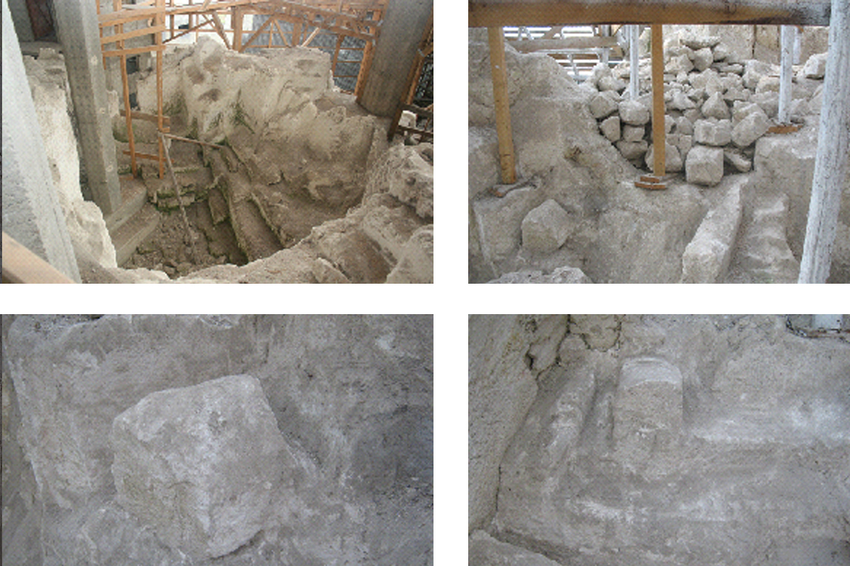
The cave complex at Murfatlar was discovered in the summer of 1957, during expansion works at the modern chalk quarry.
Archaeological research, carried out in 1957-1962 (by a team consisting of Ion Barnea, Petre Diaconu, Adrian Rădulescu, Radu Florescu, architects Virgil and Liana Bilciurescu), revealed, on the northwestern slope of Tibişir Hill, at the southwestern limit of the locality, the existence of six small churches, some cells, galleries, dwellings and tombs, all dug in chalk, as well as traces of a quarry, dating back to the 10th century AD.
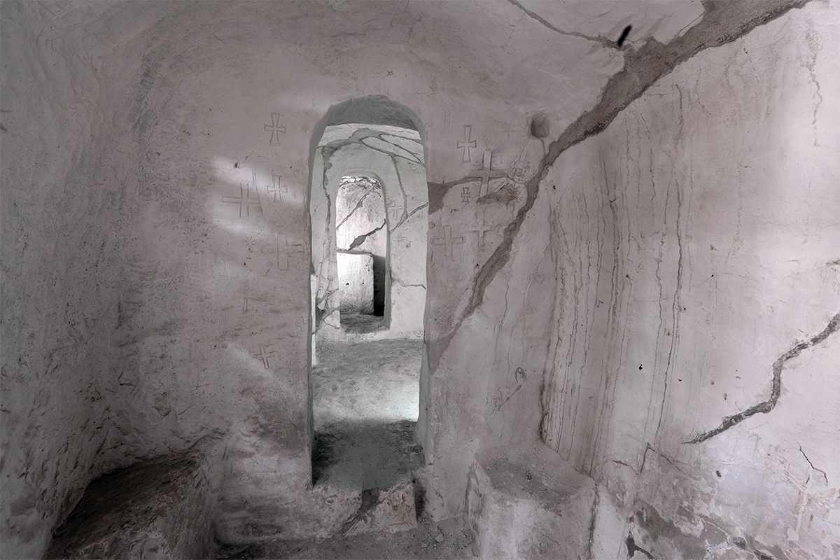
The first complex discovered was the small church B1, located in the upper part of the chalk massif. The small church has an irregular rectangular plan, divided, by means of walls cut into the chalk, into pronaos, naos and altar. Its dimensions are small, with a length of about 6 m, a maximum width of 2 m and a height of 2 – 2.15 m. Since the moment of discovery, its walls have had numerous cracks, some of which were filled with yellow clay by its users. The entrance to the church was through a narrow opening, 1.45 x 0.60 m, which is located in the north wall of the narthex.
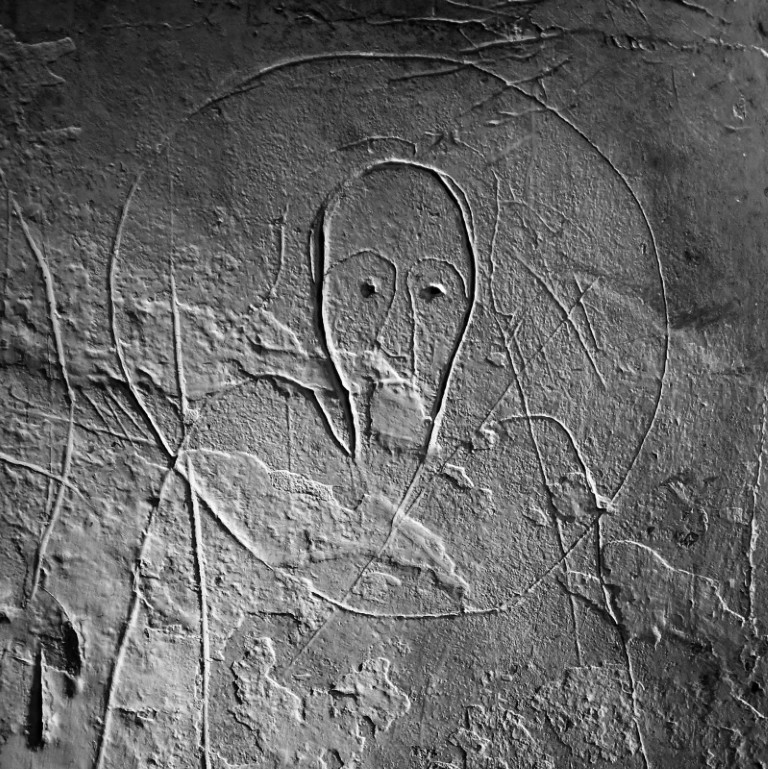
The altar, facing east, has a semicircular eastern wall and is vaulted at the top. Except for this, the walls of the complex were incised, more rarely deeply carved, cruciform and geometric signs, a rider, horses, rabbits and some Cyrillic and runic graffiti. On the outside of the B1 church, on the wall to the right of the entrance, in Cyrillic letters, the year in which the church was dug into the chalk massif is specified, "leat 6500" (i.e. 992 AD).
In front of the B1 church, slightly northwest of it, there is a large block of chalk, like a peninsula, because it remained connected to the rest of the deposit by a narrow area, in which three other churches were dug: B2 located in the upper part of it and almost on the same level as B1; B3 located below B2; respectively B4 located in the lower part of the massif, below B3. The three churches have the entrance to the northwest (where the slope of the hill is also located) and the altar to the southeast.
The B2 church has a rectangular plan, 4 x 2.20 m, and the same division as B1: pronaos, naos and altarAt the time of discovery, its upper part had collapsed, with the walls preserved to a height of about 1.50 m. Various incised signs and figures (crosses, mosquito, riders, horses, etc.) were observed in the preserved areas.
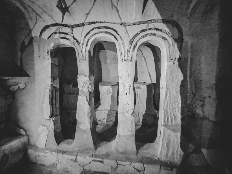
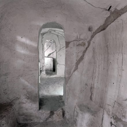
The B3 church is 4.50 x 2 m and has a maximum height of 2.10 m. Unlike the others, B3 only has naos (rectangular) and altar (semicircular), the two rooms communicating through a single opening. To the west, from the nave one can enter several small funerary rooms that communicate with each other, the last one opening into a gallery that communicates with the small church B2. These present, in the pavement or in the walls, grave pits, in some of them, human skeletons were preserved at the time of discovery.
The walls of the B3 church, the rooms on the west side and the gallery preserve numerous signs and figures incised in soft chalk. In the nave, these are found mainly in the half facing the altar and depict: the sign of the cross in various shapes and sizes (there are almost 50 examples on the east wall alone); riders, boots, halberds, horses, a sign resembling a bull's head, geometric figures, birds and some graffiti. On the walls of the burial chambers, along with the sign of the cross, riders, horses and rabbits, a ship with a mast and sails, in which a man is located, was also depicted. Two ships were also incised on the walls of the gallery that goes up to the B2 church, as well as figures of horses, deer, birds, human silhouettes and various geometric figures.
The B4 church is located almost at the base of the hill and was the last to be found in this sector. It is the largest, most imposing and also the most important in terms of the images and information it offers. It has a rectangular plan, divided by pillars, carved in chalk or built of chalk "bricks", in pronaos, naos and altar. The church is 7 x 3.50 m, and in the west wall it has a small opening through which it communicates with a tomb.
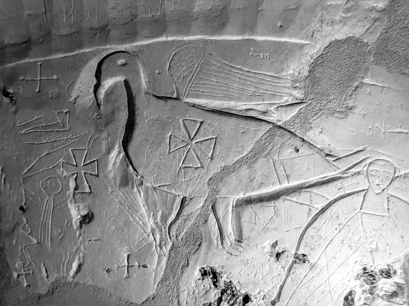
The walls of the church and the pillars were mostly covered with different signs and figures, incised or carved in soft chalk, including: crosses with simple shapes, with widened ends, in a triangle or split in two; human figures depicted kneeling or with raised arms (oranti); boots; a dove; figures of horses; "braided dragons" and the representation of a labyrinth. On the east wall of the nave, the plan of a church seems to have been sketched, and on the west wall, halfway towards the altar, there is the figure of a saint, with a halo and wards.
There are also numerous graffiti (inscriptions), mostly in runic characters, then in Cyrillic letters, Greek (two) and Glagolitic characters (one). If the content of the former is still unknown, those in Old Slavonic are religious-commemorative. Thus, in one of them, located on the wall of a pillar between the altar and the nave, the priest Aian [Dimian?] is mentioned. Another, incised on the western wall of the narthex, reproduces a text from the Gospel of Mark, and on two of the pillars separating the narthex from the nave there are two inscriptions that probably remember two local leaders, Simeon and Jupan Gheorghe. One of the two graffiti in Greek is of particular importance from a chronological point of view, as it mentions the year 982 AD, another landmark for the time placement of the monuments at Murfatlar.
West of the B1 church, almost on the same level as the B3 church, two communicating burial chambers were identified. Their entrance was, at the time of discovery, blocked with chalk boulders, as was the opening between them. On the walls of the outer chamber were incised numerous cruciform and geometric signs, human silhouettes, figures of horses, dogs, birds, "braided dragons" (some barely begun), two boots and runic graffiti.
Two other small churches, marked E 3 and E 5, are located in the southwestern part of the researched area. Of these, the small church (chapel) E3 is distinguished by an archaic plan, similar to that of the paleochristian basilicas with counter-apse. Its surface is 6 x 3.50 m, comprising altar, the naos, the pronaos (the narthex) and the exonarthexThe first was to the east and was shaped like an apse. On one side of the walls of the church were incised crosses, saints, orants, birds, a tree, the labyrinth and some runic graffiti.
The E5 church is to the east of E3, towards the interior of the chalk massif. It has an irregular quadrangular plan, with sides of about 3 m, and an average height of 2.20 m. The altar, facing east, is separated from the rest of the complex by a balustrade (cancelli), the upper part of which is no longer preserved. The E5 church communicates with E3 on the west, and to the north it has an exit to five galleries, which were used as a burial place. Its walls were also incised with crosses, fantastic animals, geometric signs and runic graffiti, as well as the image of a saint.
The six churches operated for a fairly short period of time, about half a century, but not simultaneously, but generally one after the other, the deterioration of one requiring the construction of another. Evidence in this regard is found in church B1, where the faint traces of smoking on the walls, as well as the slight dullness of the pavement and thresholds, show that it was not used for a long time.
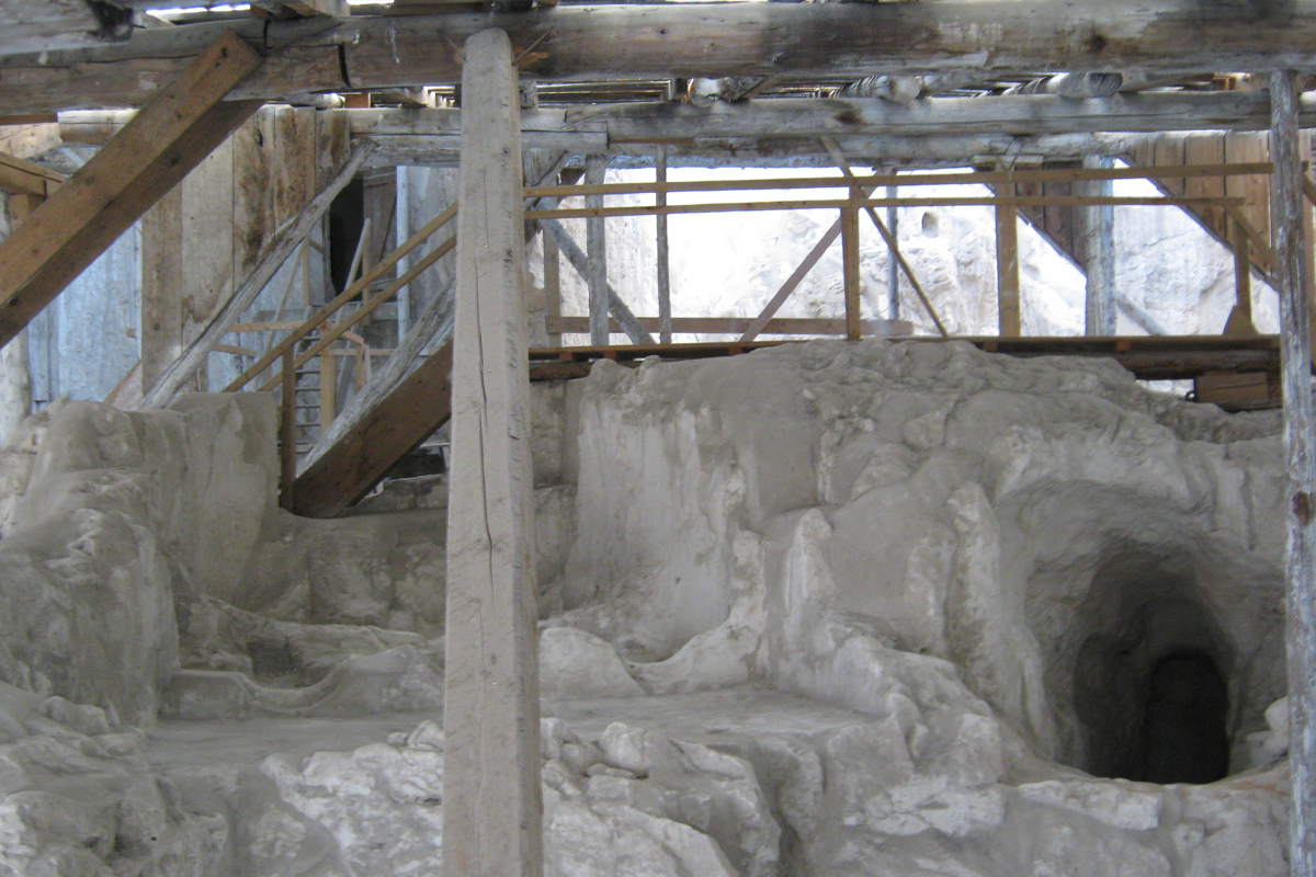
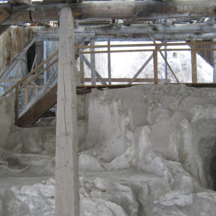
The churches, dwellings, galleries and tombs discovered in the chalk massif are closely related to the quarry mentioned above, as they were carved into the massif by the workers who worked here. In the 10th century, chalk blocks were excavated from Murfatlar and used to raise the stone wall on the segment between the localities of Murfatlar and Valea Seacă. Through exploitation, on both sides of the “peninsula-massif”, basins with depths of 10 – 15 m were formed, which were later filled with waste resulting from the carving of the chalk. Obvious traces of this activity are preserved throughout the surveyed area, and they are easily visible today.
The cave monuments at Murfatlar represent a true source of information for monastic life, religious "architecture" and, why not, the ethnic structure of the population on the Istro-Pontic territory from the early Middle Ages. The plan and the internal division of some of the churches and some architectural elements show a strong Byzantine influence. The graphic representations incised in soft chalk and the inscriptions with various characters suggest here the existence of an ethnically mixed population, a fact specified by the written sources (Cedren, Attaleiates) for the Dobrogean centers from this period.
Gallery
-

- Traces of the early medieval chalk quarry at Murfatlar
-
- The gallery connecting B2 and B3
-
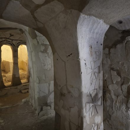
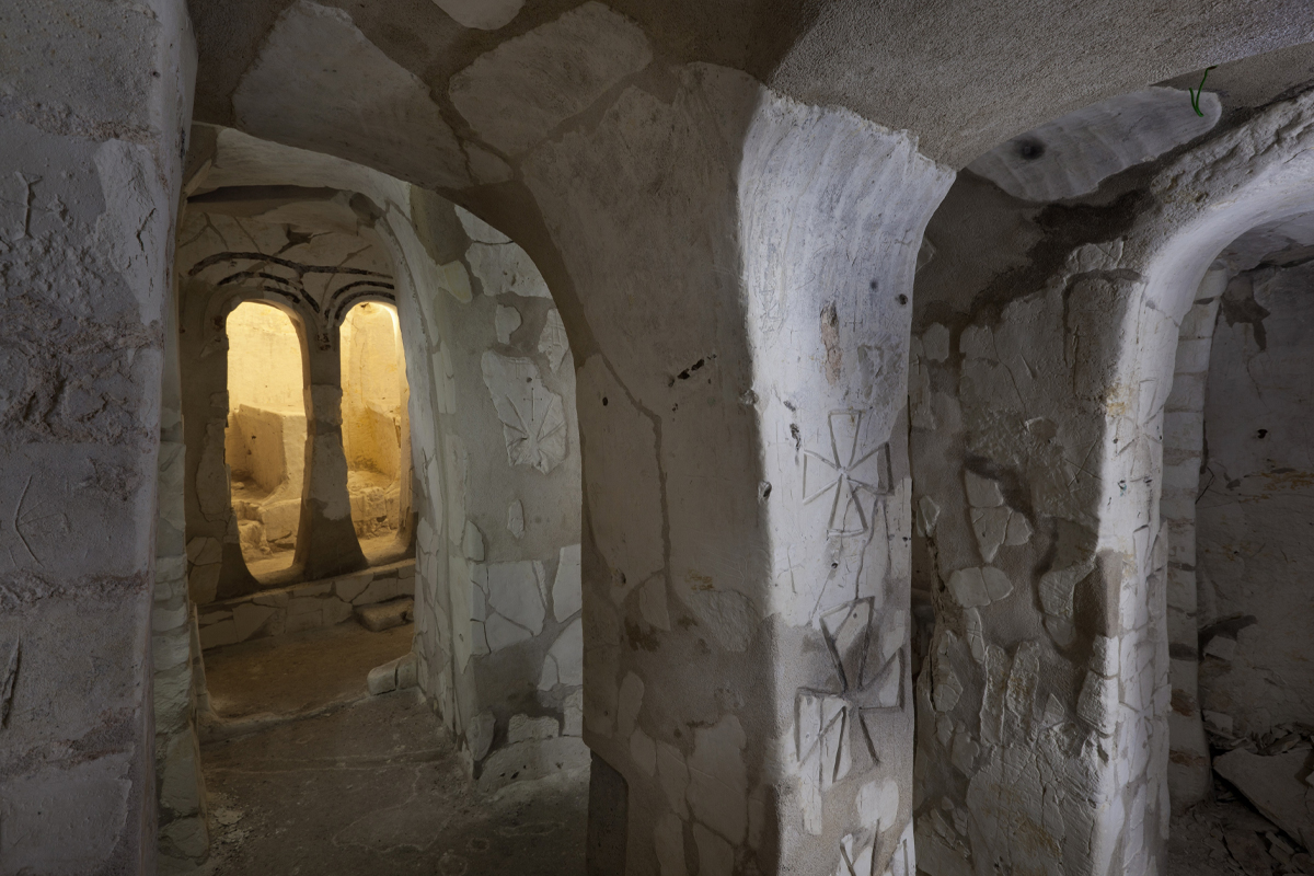
- Image from inside the church B4
-
- Image from the small church B1